http://mars3d.cn/dev/guide/data/xyzDown.html#地图url的xyz参数
https://blog.csdn.net/weixin_45782925/article/details/124360642
3D Tiles是Cesium于2016年3月定义的一种三维模型瓦片数据格式
在3D Tiles中一组数据由tileset(瓦片数据集)进行组织
https://cesium.com/learn/3d-tiling/tiler-data-formats/
1. 地形切片
瓦片文件通常按照以下规则命名:{level}/{x}/{y}.terrain
level:缩放级别 (整数)。x:瓦片在 X 轴上的索引 (整数)。y:瓦片在 Y 轴上的索引 (整数)。
1.1.1 layer.json
json
{
        "attribution": "",
        "bounds": [-180, -90, 180, 90],
        "description": "",
        "extensions": ["metadata", "octvertexnormals"],
        "format": "quantized-mesh-1.0",
        "maxzoom": 22,
        "metadataAvailability": 10,
        "minzoom": 0,
        "name": "",
        "projection": "EPSG:4326",
        "scheme": "tms",
        "tiles": ["{z}/{x}/{y}.terrain?v={version}"],
        "version": "1.1.0"
}bounds: 数据集的边界范围 (经度最小值、纬度最小值、经度最大值、纬度最大值)。minzoom: 最小缩放级别。maxzoom: 最大缩放级别。attribution: 数据来源的归属信息。tiles: 瓦片数据的 URL 模板 (例如//{s}.example.com/tiles/{z}/{x}/{y}.terrain).format: 瓦片数据的格式 (通常为quantized-mesh-1.0)
1.1.2 瓦片数据文件 (.terrain):
https://github.com/CesiumGS/quantized-mesh
查看工具:
https://github.com/heremaps/quantized-mesh-viewer
Header:
cpp
struct QuantizedMeshHeader
{
    // The center of the tile in Earth-centered Fixed coordinates.
    double CenterX;
    double CenterY;
    double CenterZ;

    // The minimum and maximum heights in the area covered by this tile.
    // The minimum may be lower and the maximum may be higher than
    // the height of any vertex in this tile in the case that the min/max vertex
    // was removed during mesh simplification, but these are the appropriate
    // values to use for analysis or visualization.
    float MinimumHeight;
    float MaximumHeight;

    // The tile’s bounding sphere.  The X,Y,Z coordinates are again expressed
    // in Earth-centered Fixed coordinates, and the radius is in meters.
    double BoundingSphereCenterX;
    double BoundingSphereCenterY;
    double BoundingSphereCenterZ;
    double BoundingSphereRadius;

    // The horizon occlusion point, expressed in the ellipsoid-scaled Earth-centered Fixed frame.
    // If this point is below the horizon, the entire tile is below the horizon.
    // See http://cesiumjs.org/2013/04/25/Horizon-culling/ for more information.
    double HorizonOcclusionPointX;
    double HorizonOcclusionPointY;
    double HorizonOcclusionPointZ;
};Data
vertex data. An unsigned int is a 32-bit unsigned integer and an unsigned short is a 16-bit unsigned integer.
yaml
struct VertexData
{
    unsigned int vertexCount;
    unsigned short u[vertexCount];
    unsigned short v[vertexCount];
    unsigned short height[vertexCount];
};Index data
cpp
struct IndexData16
{
    unsigned int triangleCount;
    unsigned short indices[triangleCount * 3];
}struct IndexData32
{
    unsigned int triangleCount;
    unsigned int indices[triangleCount * 3];
}每个瓦片文件都包含该区域的地形数据,格式为 Quantized Mesh
.terrain 文件是一个二进制文件,它并非简单的图像数据,而是经过精心设计的结构,以优化存储和渲染性能。 主要包含以下几个部分:
- Header (头部): 包含关于瓦片数据的元信息,用于快速解析文件。
- Vertex Data (顶点数据): 包含瓦片中所有顶点的位置、法线和纹理坐标等信息。 顶点的位置经过量化,以减小存储空间。
- Index Data (索引数据): 包含三角形索引,定义了如何将顶点连接成三角形网格。
- Edge Indices (边缘索引): 可选部分,用于简化地形边缘的渲染,减少裂缝。
- Extension Data (扩展数据): 可选部分,用于存储额外的属性,例如水体掩码、高度偏移等。
各部分详解:
Header:
- Magic Number (魔数): 通常用于标识文件类型,例如 "qmesh" 或者一个特定的十六进制值。
- Version (版本号): 指示 Quantized Mesh 格式的版本。
- Bounding Sphere (边界球): 一个球体,完全包含瓦片的地形。 用于视锥体裁剪,快速判断瓦片是否在视野内。 包含球心坐标 (X, Y, Z) 和半径。
- Minimum and Maximum Height (最小和最大高度): 瓦片中地形的最小和最大高度值。 用于高度缩放和量化。
- Horizon Occlusion Point (地平线遮挡点): 一个点,用于判断瓦片是否被地平线遮挡。 如果相机位于地平线遮挡点之上,则瓦片可见。 包含 X, Y, Z 坐标。
- Quantized Volume Scale (量化体积缩放): 一个比例因子,用于将量化的顶点坐标转换为实际的地理坐标。
- Quantized Volume Offset (量化体积偏移): 一个偏移量,用于将量化的顶点坐标转换为实际的地理坐标。
- Vertex Count (顶点数量): 瓦片中顶点的数量。
- Triangle Count (三角形数量): 瓦片中三角形的数量。
- Extension Bitmask (扩展位掩码): 一个位掩码,指示瓦片中包含哪些扩展数据。 例如,如果位掩码的某一位被设置,则表示瓦片包含水体掩码数据。
- Edge Mask (边缘掩码): 一个位掩码,指示瓦片的哪些边缘是可见的。 用于简化地形边缘的渲染。
Vertex Data:
- Position (位置): 每个顶点的位置信息。 位置通常使用量化的整数值表示,以减小存储空间。量化过程将实际的地理坐标映射到一个整数范围 (例如 0 到 65535)。
- X, Y, Z: 三个分量,表示顶点在局部坐标系中的位置。
- Normal (法线): 每个顶点的法线向量。 法线向量用于光照计算,确定表面的朝向。
- X, Y, Z: 三个分量,表示法线向量的方向。 法线向量通常是单位向量,长度为 1。
- Texture Coordinates (纹理坐标): 每个顶点的纹理坐标。 纹理坐标用于将纹理映射到地形表面。
- U, V: 两个分量,表示纹理坐标。 U 和 V 的范围通常是 0 到 1。
- Position (位置): 每个顶点的位置信息。 位置通常使用量化的整数值表示,以减小存储空间。量化过程将实际的地理坐标映射到一个整数范围 (例如 0 到 65535)。
Index Data:
- Triangle Indices (三角形索引): 一组整数,指示如何将顶点连接成三角形。 每个三角形由三个顶点的索引组成。
- Index Format (索引格式): 索引的格式可以是 16 位或 32 位整数,取决于瓦片中顶点的数量。 如果顶点数量小于 65536,则可以使用 16 位整数,否则需要使用 32 位整数。
Edge Indices (可选):
- Edge Indices (边缘索引): 一组整数,指示瓦片边缘的顶点索引。 用于简化地形边缘的渲染,减少裂缝。
Extension Data (可选):
- Water Mask (水体掩码): 一个图像,指示哪些区域是水体。 用于模拟水体效果。
- Height Range (高度范围): 一个范围,指示瓦片中地形的高度范围。
- Metadata (元数据): 额外的元数据,例如瓦片的创建时间、数据来源等。
2. tif切片
2.1 gdal工具
https://www.osgeo.cn/gdal/download.html
3. 影像切片
xml
<?xml version="1.0" encoding="utf-8"?>
<TileMap version="1.0.0" tilemapservice="http://tms.osgeo.org/1.0.0">
<Title>Imagery</Title>
<Abstract></Abstract>
<SRS>EPSG:3857</SRS>
<BoundingBox minx="108.2464683350843" miny="22.86146144414818" maxx="108.2509396822738" maxy="22.86619127430117"/>
<Origin x="108.2464683350843" y="22.86146144414818"/>
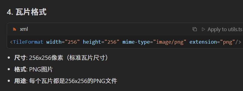
<TileFormat width="256" height="256" mime-type="image/png" extension="png"/>
<TileSets profile="mercator">
<TileSet href="11" units-per-pixel="76.43702828517625" order="11"/>
<TileSet href="12" units-per-pixel="38.21851414258813" order="12"/>
<TileSet href="13" units-per-pixel="19.10925707129406" order="13"/>
<TileSet href="14" units-per-pixel="9.554628535647032" order="14"/>
<TileSet href="15" units-per-pixel="4.777314267823516" order="15"/>
<TileSet href="16" units-per-pixel="2.388657133911758" order="16"/>
<TileSet href="17" units-per-pixel="1.194328566955879" order="17"/>
<TileSet href="18" units-per-pixel="0.5971642834779395" order="18"/>
<TileSet href="19" units-per-pixel="0.2985821417389697" order="19"/>
<TileSet href="20" units-per-pixel="0.1492910708694849" order="20"/>
<TileSet href="21" units-per-pixel="0.07464553543474244" order="21"/>
<TileSet href="22" units-per-pixel="0.03732276771737122" order="22"/>
<TileSet href="23" units-per-pixel="0.01866138385868561" order="23"/>
</TileSets>
</TileMap>- <TileMap version="1.0.0" tilemapservice="http://tms.osgeo.org/1.0.0">
- version="1.0.0": TileMap规范版本
- tilemapservice: 指向TMS(Tile Map Service)标准
- Title: 瓦片地图标题为"Imagery"(影像)
- EPSG:3857: Web Mercator投影,也叫"伪墨卡托"